


Height above sea in Bangkok May affect your home in the rainy season. or when flooding occurs Let’s check each other as a guideline for coping.
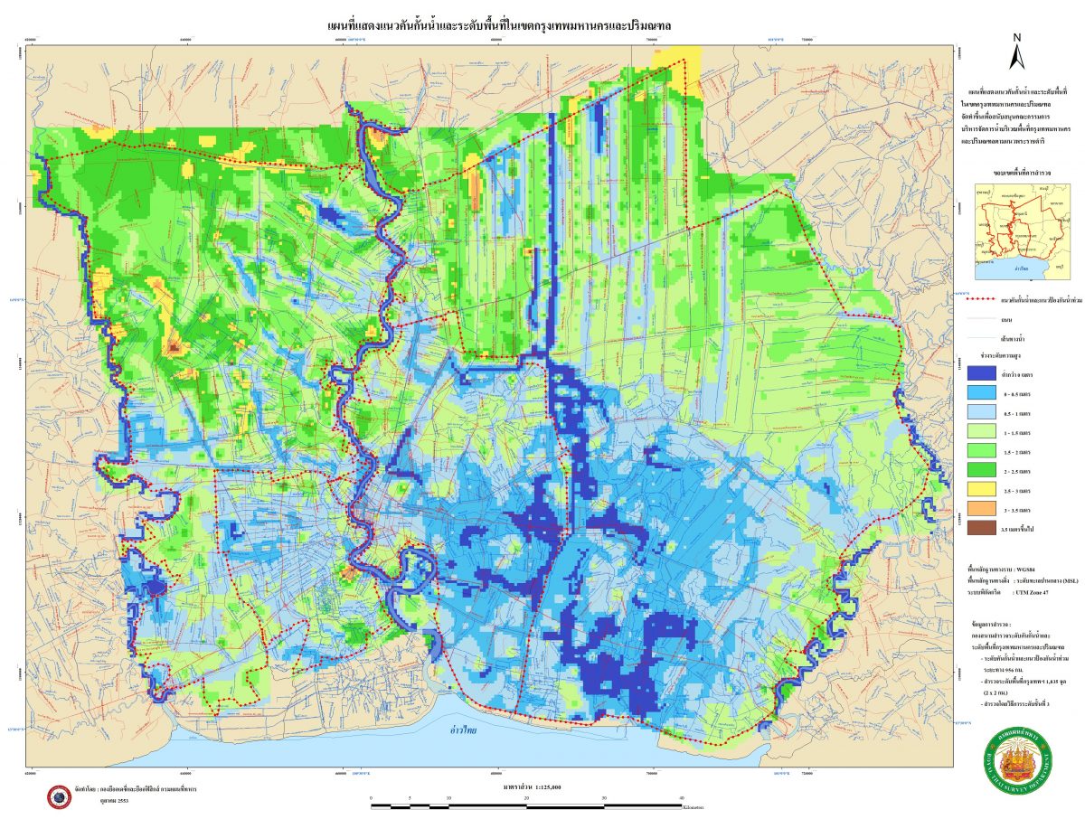
The data from the Military Cartography Department presented in detail includes the height above sea level for each area. in Bangkok and surrounding areas Low heights are represented by colors. For the location of the house of someone with a dark blue color, they may have to prepare to deal with a lot, such as around Rom Klao Road. and Bangna-Trad at certain times When it rains, the area becomes a basin, causing the water to drain more slowly than other areas.Height above sea in Bangkok
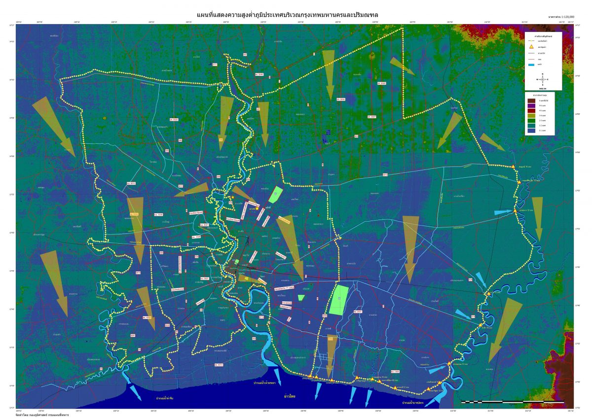
In addition, the map in the second image is a map showing a waterway that shows the direction of water flowing into the river and the Gulf of Thailand. Plus, with a satellite map that can be viewed in more detail. You can check the exact location of your house and the elevation from the sea, click http://www.hep.caltech.edu/~piti/bkk_height/
Read more :
- Ways to deal with problems in the house after the water recedes
- Prevent flooding, backwater, snakes, rodents, insects from entering the pipes in the house as well. waterproof back valve
- Restoring gardens and taking care of plants after flooding
- The water recedes… ideas pop up – how to manage after the flood.
- Repair walls and ceilings after flooding
- How to prevent flooding from the street from flowing into the house